
The Route of the 4 Valleys
Hiking
The "Route of the 4 Valleys" is a trail project that the Municipality of Montelupo is developing in collaboration with the CAI section of Scandicci.
Initially based on an idea by the Circolo il Progresso, which recognized the hiking potential of our area, this route is named after the main valleys it crosses: the first foothill of the Lower Valdarno, the Turbone Valley, the Virginio Valley, and the Pesa Valley.
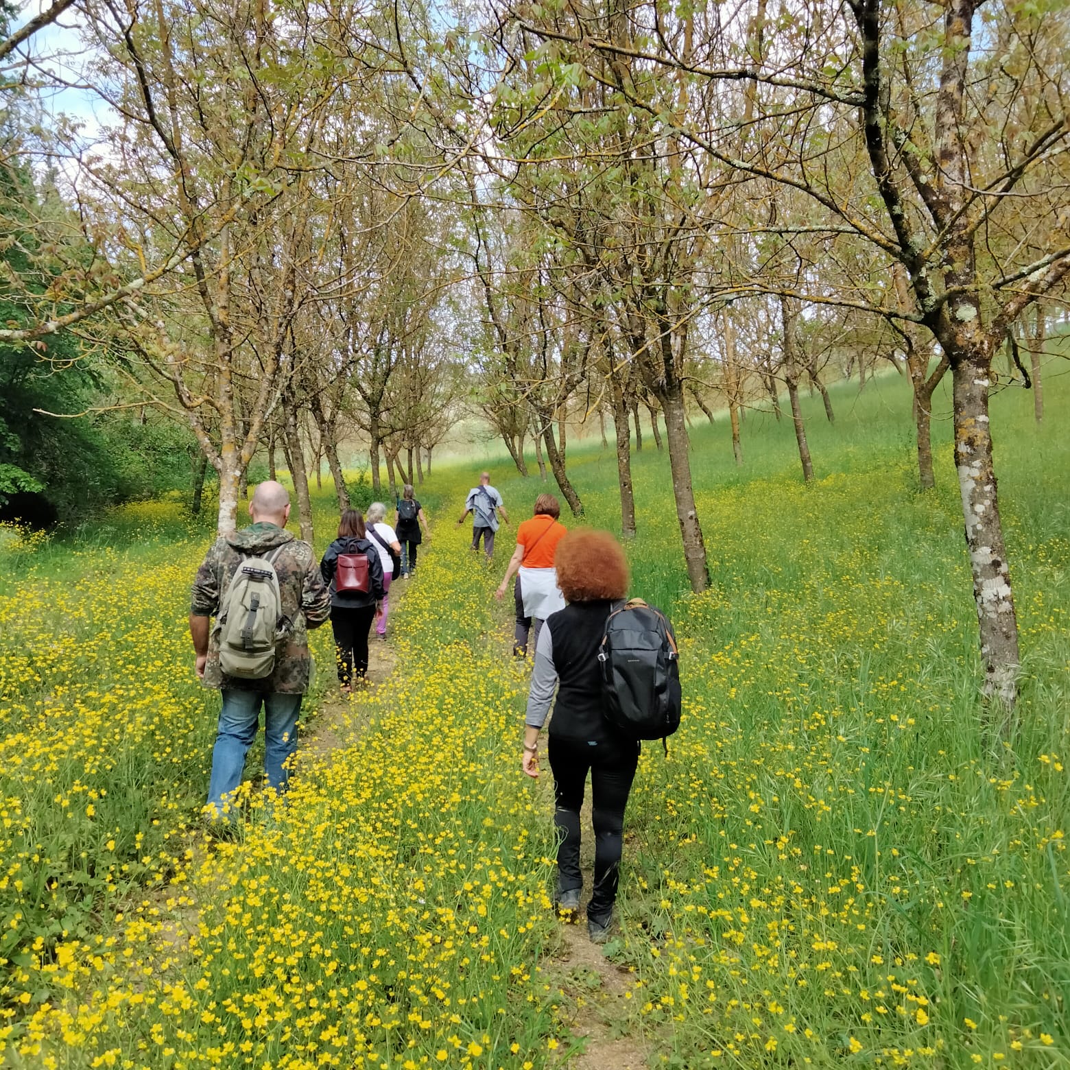
Currently, the first loop (476) has been completed, starting from Sammontana, ascending to Botinaccio, and then descending towards the Arno. Here is the GPX track.
This initial route, whose totale ascent is 240 meters, is also accessible by mountain bike and approximately 9.5 km long, and it leads us to discover a charming area with a rich history.
Between History and Nature
Walking through this fascinating itinerary, you will find lakeside and wild environments, along with well-tended and fertile fields, surrounded by woods. You will discover a diverse and captivating landscape: from historical villas and farms in the countryside to ancient aqueducts that used to bring water from the Sammontana springs to the famous lion fountain in Farinata degli Uberti Square in Empoli. Hydraulic works that used to contribute to the functioning of ancient mills on the Val di Botte stream, but also places that were the background of historical events and mysterious legends. From the “dance of the gnudi” in Montecastello, cradle of the Frescobaldi family, to Berto’s tomb and the votive chapels of Quarantola and so much more: the “Route of the 4 Valleys” will intrigue you and take you on a dream-like journey.
The second loop, currently still under development, will be connected directly to the first one through three access points, twisting and turning among Turbone, Pulica/Poggio Capponi, the Virginio, and the Pesa.
Access Modes
- hiking
- bike